Funded Projects
- 09. 2023 – 08. 2026. Co-Principle Investigator, IHBEM: The fear of here: Integrating place-based travel behavior and detection into novel infectious disease models. NSF
- 11. 2021 – 10. 2026. Co-Investigator, National AI Institute for Intelligent CyberInfrastructure with Computational Learning in the Environment (ICICLE). NSF
- 09.2021 – 08. 2022. Principle Investigator, Quantifying Neighborhood Spatial-Racial Differences on Place-Oriented Health Measures. County Health Rankings & Roadmaps
- 09. 2021 – Now Principle Investigator, Academic-Industry Partnership Grant between UW-Madison and Arity
- 09. 2020 – 12.2021. Principle Investigator, A Deep Learning Approach to User Location Privacy Protection. American Family Insurance Data Science Institute (AmFam DSI) Funding Initiative
- 07. 2020 – 06. 2022. Co-Principle Investigator, A Translational and Multidisciplinary Approach to Redistricting. UW-Madison 2020 innovative and groundbreaking research Round 6.
- 05. 2020 – 05. 2023. Principle Investigator, Spatial Data Science Approach to Health Professional Service Area Identification. Wisconsin Department of Health Services
- 04. 2020 – 09. 2021. Principle Investigator, Geospatial Modeling of COVID-19 Spread and Risk Communication by Integrating Human Mobility and Social Media Big Data. NSF
- 01. 2020 – 06. 2022. Co-Principle Investigator, Collaborative Research: A GeoAI Data-Fusion Framework for Real-Time Assessment of Flood Damage and Transportation Resilience by Integrating Complex Sensor Datasets. NSF
- 09. 2019 – 2021. 08. Principle Investigator, StreetPlay: Scoring neighborhood playability in U.S. metropolitan areas using street view images and deep learning. Microsoft AI for Earth research grants
- 09. 2019 – 08. 2020. Principle Investigator, Academic-Industry Partnership Grant between GeoDS Lab and Wework
- 09. 2019 – 08. 2020. Collaborator, Geo-mapping antimicrobial resistance in E. coli from humans & animals. 2019 UW ICTR-Marshfield Clinic Pilot Project Award
- 09. 2019 – 08. 2020. Principle Investigator, Understanding Neighborhood Isolation through Human Mobility Big Data Analytics. UW-Madison Fall Research Competition Award
- 09. 2018 – 08. 2019. Principle Investigator, Advancing Location Privacy Preserving Methods and Technologies in Social Sensing. UW-Madison Fall Research Competition Award
- 09. 2017 – 08. 2018. Principle Investigator, A Data-Synthesis-Driven Approach to Place-Based Social Sensing. UW-Madison Fall Research Competition Award
Research Topics
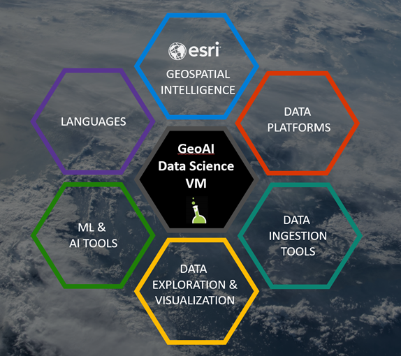
GeoAI
GeoAI is bringing together geoscientists, computer scientists, engineers, entrepreneurs, and decision makers from academia, industry, and government to discuss the latest trends, successes, challenges, and opportunities in the field of artificial intelligence for transforming cartography and geographic information science.
Read more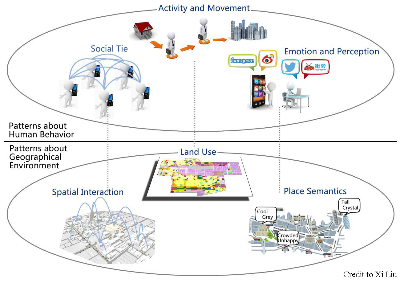
Social Sensing
The emergence of big data brings new opportunities for us to understand our socioeconomic environments. We use the term social sensing for such individual-level big geospatial data and the associated analysis methods.
Read more
Spatiotemporal Data Analytics
Spatiotemporal analytics, computation, mining, and integration with visual representation help understand complex phenomena and reveal hidden patterns.
Read more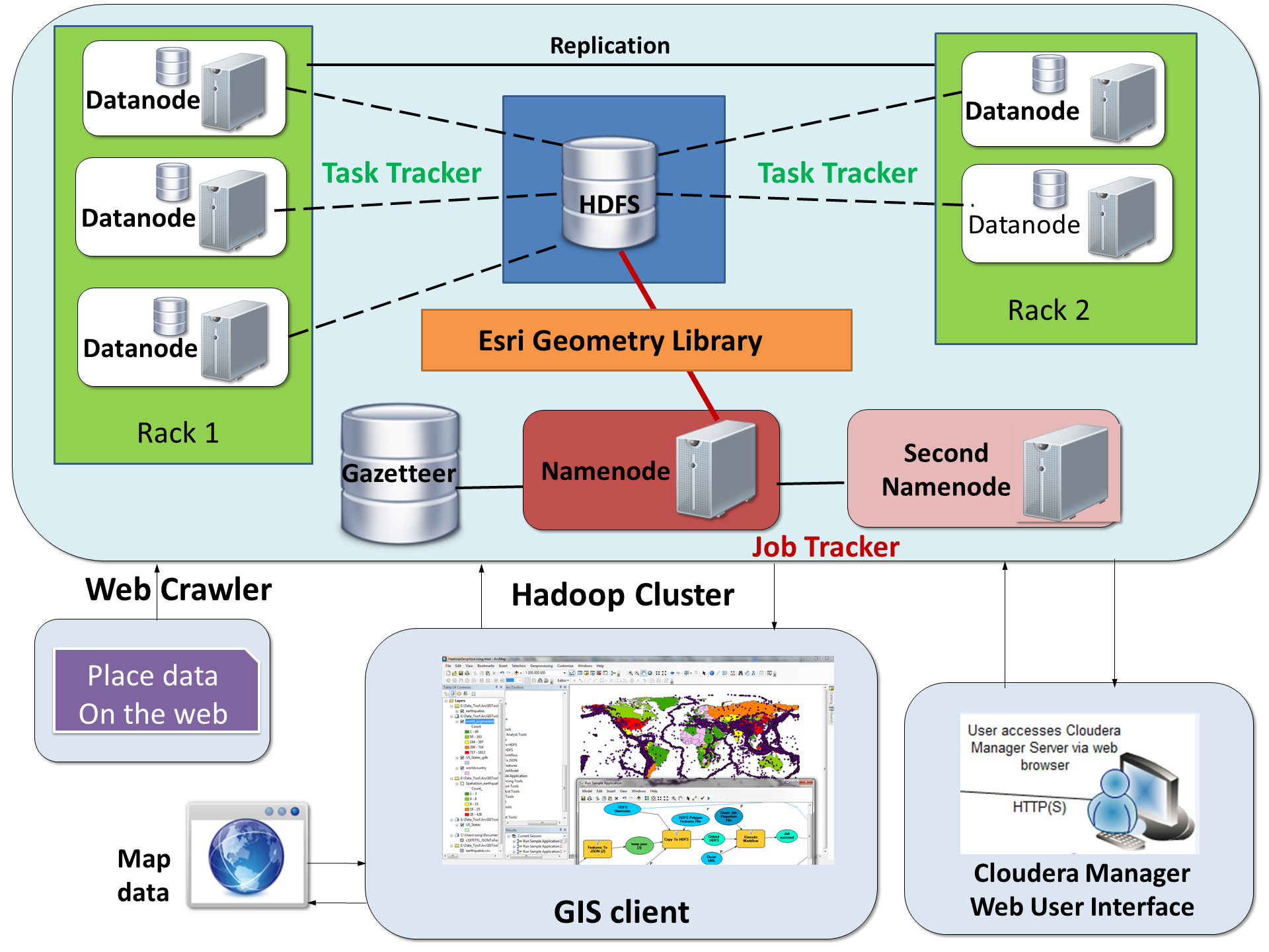
GeoComputation and Big Data
Geospatial Big Data describes the phenomenon that large volumes of georeferenced data captured by millions of environmental and human sensors in a variety of formats such as remote sensing images, crowdsourced maps, geotagged videos and photos, transportation smart card transactions, mobile phone data, location-based social media content, and GPS trajectories.
Read more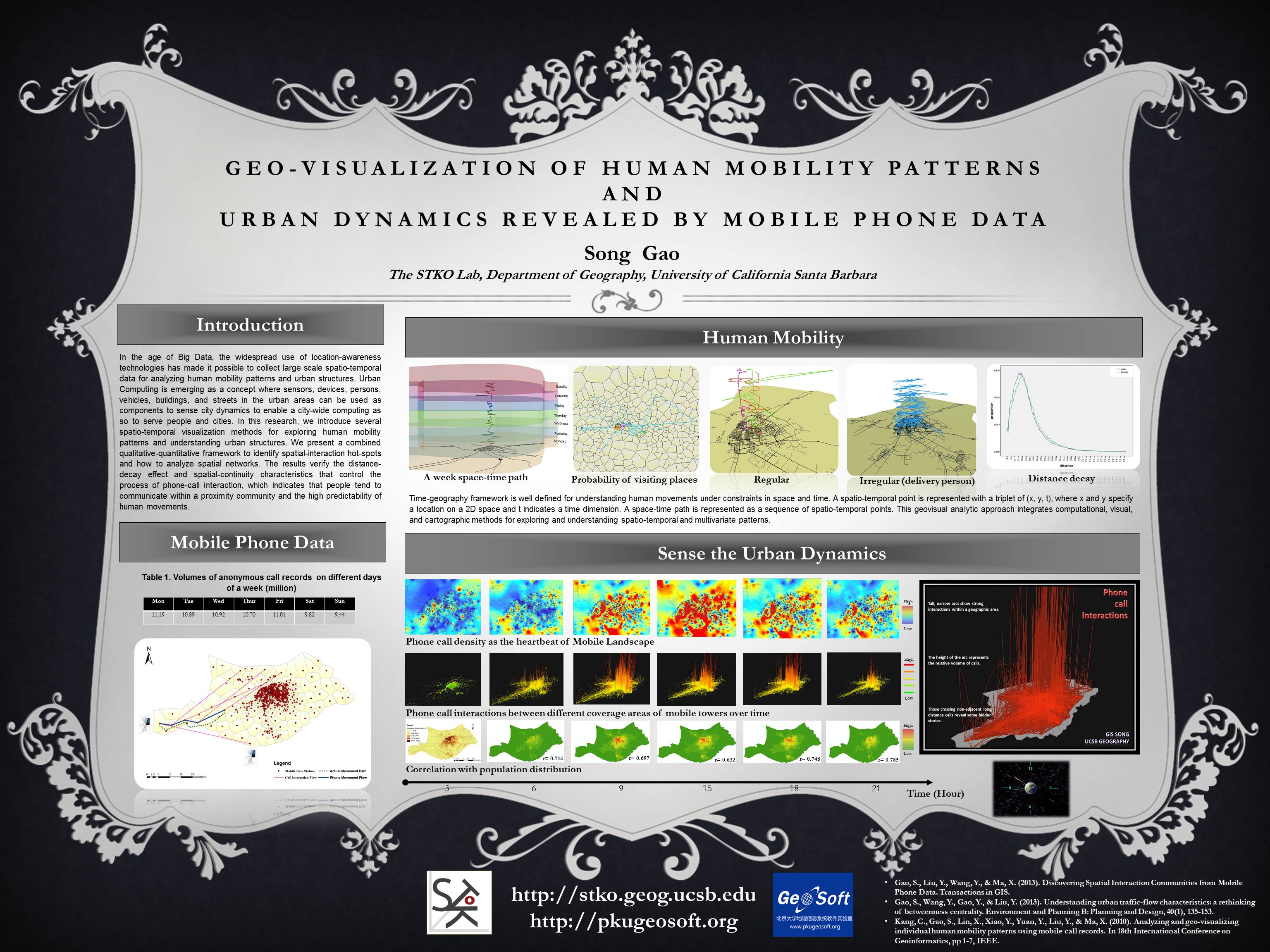
Human Mobility and Urban Computing
The widespread use of location‐awareness technologies and smart phones has made it possible to collect large scale spatiotemporal data for analyzing human mobility patterns and complex urban dynamics.
Read more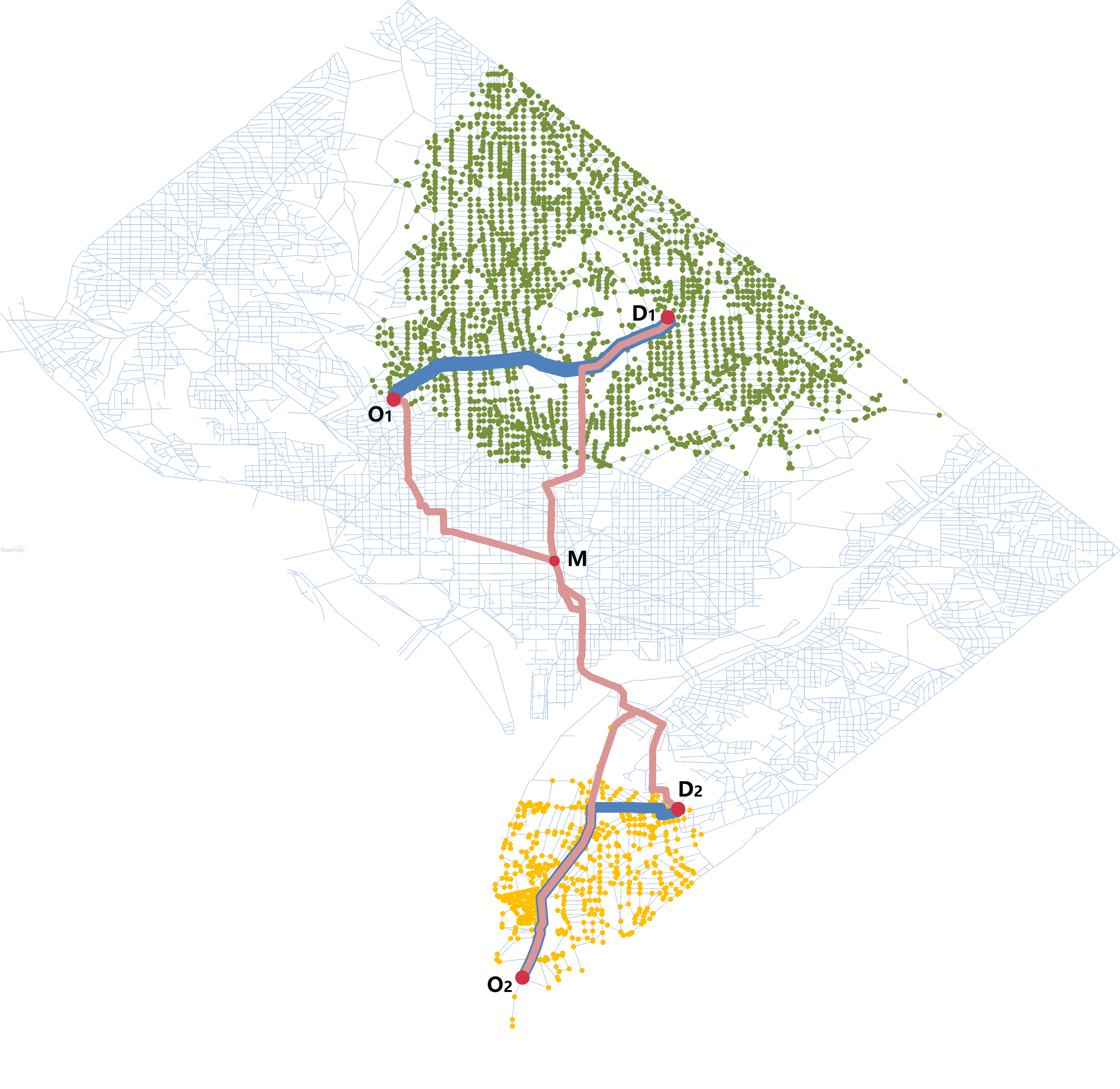
Spatial Networks and Transportation
A spatial network is a graph in which the vertices or edges are spatial elements associated with geometric objects. It plays a very important role in transportation operation and management and many other fields.
Read more
A Data-Driven Approach to Place-Based GIS
A place is characterized by its semantics and human conceptualizations instead of just an abstract geometry in space. The emergence of big data brings new opportunities for us to understand the semantics of places and associated human experiences, emotions, movements, and activities.
Read more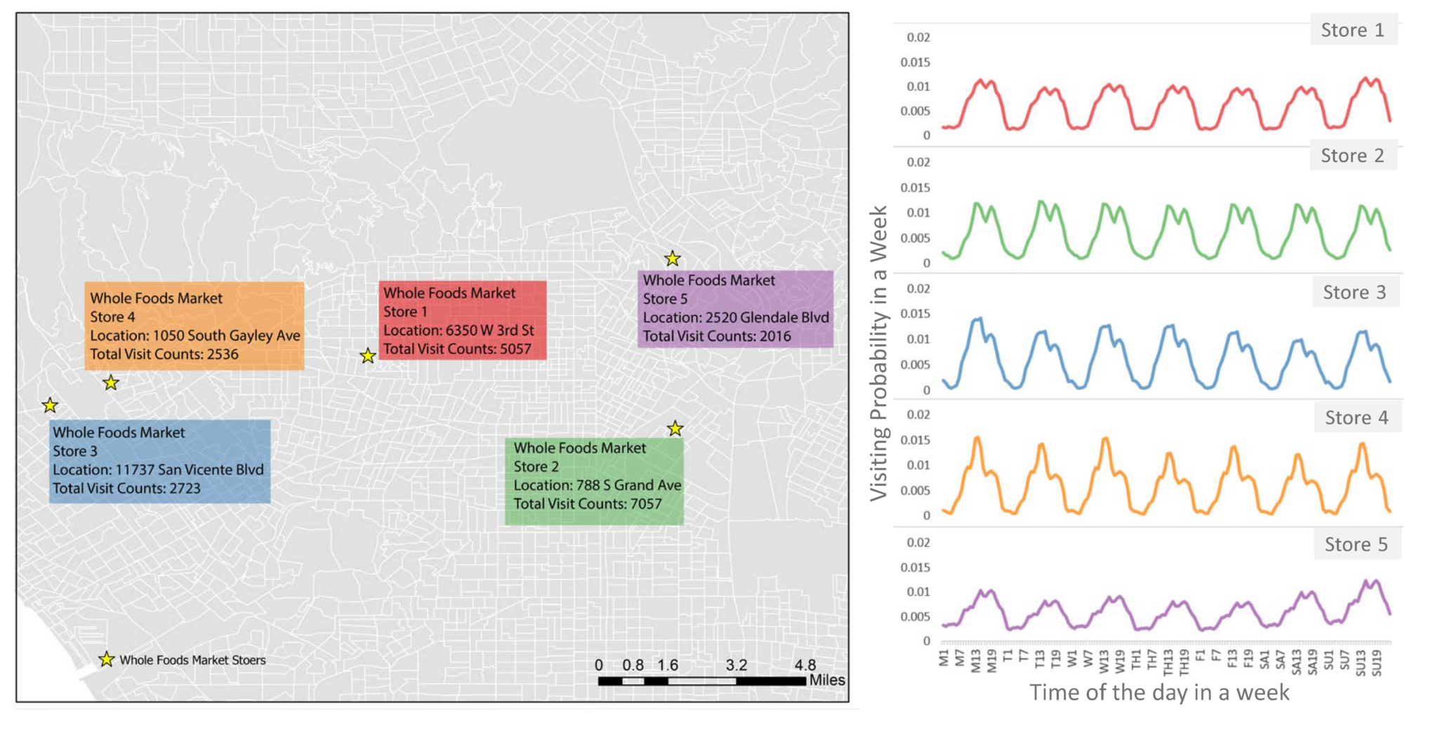
Location Big Data for Business Analytics
Location information is a key component in business intelligence analytics (e.g., foot-traffic and trade areas) and implementation of crucial, revenue‐generating marketing strategies, such as location‐based advertisement and services.
Read more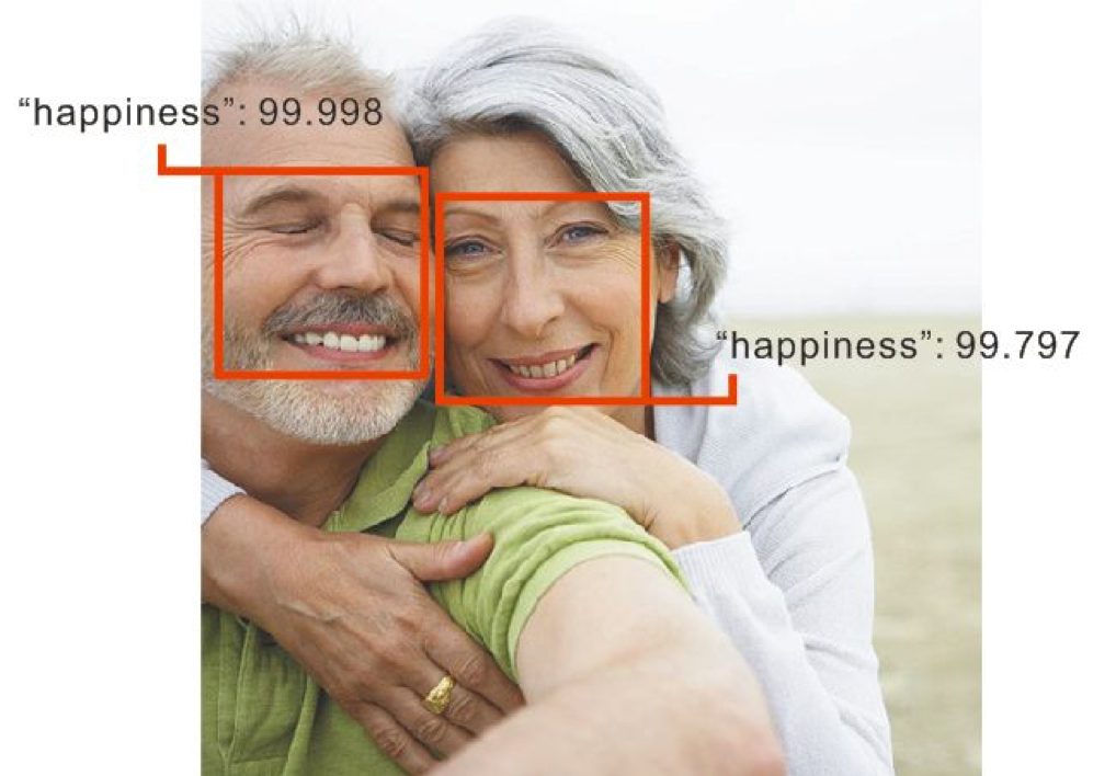
Place Emotion
State-of-the-art computer vision technologies are utilized to collect, store, handle, manipulate and analyze the human emotion at different places. The research explored what and how people express their emotions at different scales and places, and why and how their emotions would be influenced by environmental factors.
Read more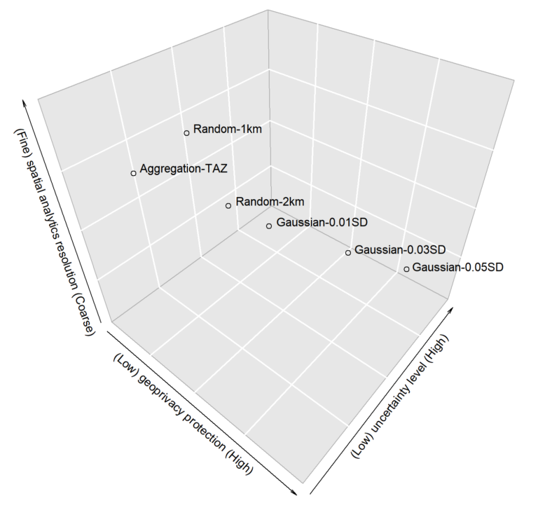
Location Privacy
Large-scale individual-level location data has been widely collected through location-awareness devices. Geoprivacy concerns arise on the issues of user identity de-anonymization and sensitive location exposure. Advanced methods and techniques for protecting the geoprivacy are required.
Read morePublic Health
Using GIS tools, spatial statistics, and interactive mapping to better understand the spatiotemporal distributions of air pollution, diseases and interactions with environmental factors that may influence human health issues.
Read more