GeoDS Lab members won multiple awards in the AAG 2020 Annual Meeting

Due to the COVID-19 pandemic, The American Association of Geographers (AAG)  2020 Annual Conference was held online virtually. GeoDS Lab members participated the meeting and fortunately won several awards as follows.

Congratulations to Yuhao Kang who won the 1st place in the 2020 AAG GIS Specialty Group Annual Best Student Paper Competition and the 2020 AAG Cartography Specialty Group Master’s Thesis Research Grant.
http://aag-giss.org/2020-aag-geographic-information-science-and-systems-specialty-group-annual-student-paper-competition-winners/

https://aagcartography.wordpress.com/awards-competitions/masters-thesis-research-grant/

In addition, GeoDS Lab’s recent COVID-19 mapping work was awarded the winner of static mapping group for the “AAG Health and Medical Geography Health Data Visualization Contest”.

Also, GeoDS Lab’s recent COVID-19 work was featured by the AAG Newsletter:

http://news.aag.org/2020/03/geographers-act-on-covid19/

County-to-County- Spring Travel Flow Tracking

Prof. Gao received a NSF RAPID grant in response to COVID-19

Recently, a multidisciplinary research team led by Prof. Song Gao (Geography) who serves as the Principal Investigator (PI) and collaborates with three other Co-PIs at UW-Madison: Prof. Kaiping Chen (Life Sciences Communication), Prof. Qin Li (Mathematics), and Prof. Jonathan Patz (Population Health Sciences), was awarded an NSF RAPID grant in response to the COVID-19 pandemic. The project title is: “Geospatial Modeling of COVID-19 Spread and Risk Communication by Integrating Human Mobility and Social Media Big Data”.

This project will investigate the gap between the science of epidemic modeling and risk communication to the general public in response to the COVID-19 pandemic. With the rapid development of information, communication, and technologies, new data acquisition and assessment methods are needed to evaluate the risk of epidemic transmission and geographic spreading from the community perspective, to help effectively monitor social distancing policies, and to understand social disparities and environmental contexts in risk communication. This project will make theoretical, methodological, and practical contributions that advance the understanding of the COVID-19 spread across both time and space. The communication aspects of this research will serve to educate communities about the science, timing, and geography of virus transmission in order to enhance actions for addressing such global health challenges. This project explores the capabilities and potential of integrating social media big data and geospatial artificial intelligence (GeoAI) technologies to enable and transform spatial epidemiology research and risk communication. Results will be disseminated broadly to multiple stakeholder groups. Further, this project will support both researchers and students from underrepresented groups, broadening participation in STEM fields. Lastly, the Web platform developed in this project will serve as an education tool for students in geography, communication, mathematics, and public health, as well as for effectively engaging with communities about the science of COVID-19.

Past health research mainly focuses on quantitative modeling of human transmission using various epidemic models. How to effectively communicate the science of an epidemic outbreak to the general public remains a challenge. When an epidemic outbreak occurs without specific controls in place, it can be particularly challenging to improve community risk awareness and action. The research team, composed of experts from geography, mathematics, public health and life sciences communication will (1) develop innovative mathematical predictive models that integrate spatio-temporal-social network information and community-centered approaches; (2) integrate census statistics, human mobility and social media big data, as well as policy controls to conduct data-synthesis-driven and epidemiology-guided risk analysis; And (3) utilize panel surveys and text mining techniques on social media data for better understanding public awareness of COVID-19 and for investigating various instant message and visual image strategies to effectively communicate about risks to the public. The results of this project will lead to a better understanding of the geography and spread of COVID-19. Additionally, it is expected that the methods developed in this project can be applied to mitigate the outbreak risks of future epidemics.

The research team will also collaborate with The Wisconsin State Cartographer’s Office (SCO), The Wisconsin Department of Health Services (DHS), The American Family Insurance Data Science Institute (DSI), and The Global Health Institute (GHI).

Read our recent work: Mobile location big data can help predict the potential infected areas as coronavirus spreads


Mobile location big data can help predict the potential infected areas as coronavirus spreads

The travels and close contact-tracing from/to infected communities is useful for identifying potential hotspots and assessing the potential risk across different places. A recent research published in Science showed that “substantial undocumented infection facilitates the rapid dissemination of novel coronavirus (SARS-CoV2) “. Understanding the human physical movement patterns and social contacts is a key for saving more lives as one may be surrounded by latent exposed people who don’t show SARS-CoV2 symptoms. Therefore, human mobility patterns and changes could be one indicator for understanding the status of physical social distancing. Here are the neighborhood mobility pattern and the Spring 2019 and March 2020 travel patterns for US cities and counties using the anonymized and aggregated mobile phone location big data in collaboration with SafeGraph, which covers over 3.6 million points of interest (POI) and business venues with visit patterns. Meanwhile, we are working on the whole US 2020 census block data and monitoring new infected areas from the CDC and from a list of Coronavirus dashboards in response to COVID-19.

Reference: Gao, S., Rao, J., Kang, Y., Liang, Y., & Kruse, J. (2020). Mapping county-level mobility pattern changes in the United States in response to COVID-19. SIGSPATIAL Special. 12(1), 16-26.

The spatial density distribution of over 3.6 million SafeGraph POIs with visit patterns.

The U.S. government, tech industry are discussing ways to harness smartphone location data to combat the novel coronavirus (COVID-19).

You can find out where people from those POIs / neighborhoods / a county connecting with other neighborhoods and counties across the US. By comparing the POI visits between last March and March 2020, we can summarize the changes and visualize the patterns on the maps to understand whether people in each County/State has reacted to (Physical) Social Distancing.

Interactive Web: Mapping Human Mobility Changes at the County level since March 1, 2020

Mapping Human Mobility Changes at the County level in March, 2020 (Data Source: Descartes Labs )
See also: https://www.nytimes.com/interactive/2020/03/23/opinion/coronavirus-economy-recession.html

Interactive Web on COVID-19 Physical Distancing and the relation with the infectious cases in Wisconsin (Using the latest SafeGraph weekly movement patterns in March 2020): https://geods.geography.wisc.edu/covid19/WI/

In addition, the maps below show the origin-destination (OD) flows larger than a travel frequency threshold at different spatial scales. The one at the urban scale can help understand the potential spread and hotspots in a city/metropolitan area.

Interactive Web: geods.geography.wisc.edu/covid19/King_WA.html (Notice that some paired neighborhood-to-neighborhood flows are not shown after the data filtering based on OD flow frequency)
Interactive Web: https://geods.geography.wisc.edu/covid19/King_US.html (neighborhood mobility to San Francisco, Alaska, Boston, and New York, etc. stand out. )

Spring Travel Risk

By using the county-level Spring travel data in March, we can see thousands of trips generated from the U.S. counties in the Spring season and widely across the U.S., which may help explain the rapid growth of infection cases across the whole U.S. Our travel-augmented SEIR epidemic modeling results showed that only about 20% of infected cases reported (with testing) at the state level in the US.

Chen, S., Li, Q., Gao, S., Kang, Y.,& Shi, X.(2020). State-specific Projection of COVID-19 Infection in the United States and Evaluation of Three Major Control Measures. Scientific Reports, 1-9, www.nature.com/articles/s41598-020-80044-3.

Interactive Web demo: Dane County, WI

The spring travels from the Dane County, WI with current U.S. confirmed cases: http://geods.geography.wisc.edu/covid19/WI_DaneCounty.html

Interactive Web: The King County, WA https://geods.geography.wisc.edu/covid19/KingCounty_Spring.html

Spring travels patterns aggregated at the Country-level in March 2019 from the people who reside in the King County, WA
Spring travels patterns aggregated at the County-level in March 2019 from the people who reside in the King County, WA
(Zoom in to the Pacific Coast Map) Spring travels patterns aggregated at the County-level in March 2019 from the people who reside in the King County, WA

The following table shows the top 20 counties which the people reside in the King County traveled to in March 2019.

And using the Country-to-US Counties flow data from last March, we can assess how the global travels from other countries outside of US will influence the potential coronavirus outbreak and spread in the US.

The spring international travels to US in March 2019. (filtered by at least 100 people)
The spring travels from China and Japan in March 2019.

Credit: The data sources were from SafeGraph Inc., Descartes Labs, and the Web geovisualization was created using the Kepler.gl tool.

Acknowledgment: We would like to thank all individuals and organizations for collecting and updating the COVID-19 observation data and reports. Dr. Song Gao acknowledges the funding support provided by the National Science Foundation (Award No. 2027375). Any opinions, findings, and conclusions or recommendations expressed in this material are those of the author(s) and do not necessarily reflect the views of the National Science Foundation.

New research article about Regional Economy and Transportation Network Analytics published in Scientific Reports

Bin Li, Song Gao, Yunlei Liang, Yuhao Kang, Timothy Prestby, Yuqi Gao, and Runmou Xiao. (2020) “Estimation of Regional Economic Development Indicator from Transportation Network Analytics.” Scientific Reports, 10(2647), 1-15. DOI: https://doi.org/10.1038/s41598-020-59505-2

Abstract: With the booming economy in China, many researches have pointed out that the improvement of regional transportation infrastructure among other factors had an important effect on economic growth. Utilizing a large-scale dataset which includes 3.5 billion entry and exit records of vehicles along highways generated from toll collection systems, we attempt to establish the relevance of mid-distance land transport patterns to regional economic status through transportation network analyses. We apply standard measurements of complex networks to analyze the highway transportation networks. A set of traffic flow features are computed and correlated to the regional economic development indicator. The multi-linear regression models explain about 89% to 96% of the variation of cities’ GDP across three provinces in China. We then fit gravity models using annual traffic volumes of cars, buses, and freight trucks between pairs of cities for each province separately as well as for the whole dataset. We find the temporal changes of distance-decay effects on spatial interactions between cities in transportation networks, which link to the economic development patterns of each province. We conclude that transportation big data reveal the status of regional economic development and contain valuable information of human mobility, production linkages, and logistics for regional management and planning. Our research offers insights into the investigation of regional economic development status using highway transportation big data.

Fig. Mapping the annual traffic volumes of cars and buses among cities in Shaanxi province from 2014 to 2017.
Fig. The Pearson’s correlation coefficients between city GDP value, betweenness, closeness centrality measures and the PageRank index in transport flow networks of cars & buses (C) and trucks (K) in three provinces. The Betw (D) and Closeness (D) measures are calculated using the spatial interaction networks of cities with the inter-city distances as edge weights.

Fig. Mapping the annual traffic volumes of trucks among cities in Jiangsu province in 2017.
Fig. Mapping the annual traffic volumes of trucks among cities in Liaoning province in 2017.

Geomasking techniques for protecting the location privacy of social media users

Figure 1: The spatial distribution of geotagged tweets around a Twitter user’s home.

Reference: Song Gao, Jinmeng Rao, Xinyi Liu, Yuhao Kang, Qunying Huang, Joseph App. (2019) Exploring the effectiveness of geomasking techniques for protecting the geoprivacy of Twitter users. Journal of Spatial Information Science. 19, 105-129. DOI: 10.5311/JOSIS.2019.19.510 [PDF]

Abstract: With the ubiquitous use of location-based services, large-scale individual-level location data has been widely collected through location-awareness devices. Geoprivacy concerns arise on the issues of user identity de-anonymization and location exposure. In this work, we investigate the effectiveness of geomasking techniques for protecting the geoprivacy of active Twitter users who frequently share geotagged tweets in their home and work locations. By analyzing over 38,000 geotagged tweets of 93 active Twitter users in three U.S. cities (Los Angeles, Madison, and Washington D.C.), the two-dimensional Gaussian masking technique with proper standard deviation settings is found to be more effective to protect user’s location privacy while sacrificing geospatial analytical resolution than the random perturbation masking method and the aggregation on traffic analysis zones. Furthermore, a three-dimensional theoretical framework considering privacy, spatial analytics, and uncertainty factors simultaneously is proposed to assess geomasking techniques. Our research offers insights into geoprivacy concerns of social media users’ georeferenced data sharing for future development of location-based applications and services.

Figure 2: The Gaussian geomasking with different standard deviations (SD) and the random perturbation with 1km and 2km threshold of a user’s geotagged tweets.
Figure 10: The violin plot of distance shifts of tweet locations after geomasking.
Figure 11: A 3D-cube framework for assessing different geomasking techniques; the position of each method is estimated from the results of our case study.

Broader Impacts: In fact, Twitter removes support for precise geotagging since June, 2019. However, the metadata of historical tweets prior to the policy change may still reveal precise GPS coordinates. In addition, when a user deletes a geotagged tweet , Twitter does not guarantee the information will be completely removed from all copies of the data on third-party applications or in external search results. Even if the precise GPS location is not available anymore, Twitter users are still able to add place tags (e.g., a city, office building, apartment, landmark, and many other types of places) to their geotagged tweets, which can be converted to the GPS coordinates (often using the centroid as a representation location). This is similar to the aforementioned aggregation-based masking approach, thus we may still be able to get users’ sensitive locations based on fine-scale place tags. People should be aware that sharing or publishing such kind of location data involve geoprivacy issues and the geomasking technique provides a way to help mitigate the problem not only for Twitter users but also for other telematics and social media platforms such as Facebook, Flickr, Weibo, and Instagram where geotagging or place-tagging is accessible, as well as for mobile applications that track individual locations.

GeoAI at ACM SIGSPATIAL: progress, challenges, and future directions

Geospatial artificial intelligence (GeoAI) is an interdisciplinary field that has received tremendous attention from both academia and industry in recent years. We recently published an article that reviews the series of GeoAI workshops held at the Association for Computing Machinery (ACM) International Conference on Advances in Geographic Information Systems (SIGSPATIAL) since 2017. These workshops have provided researchers a forum to present GeoAI advances covering a wide range of topics, such as geospatial image processing, transportation modeling, public health, and digital humanities. We provide a summary of these topics and the research articles presented at the 2017, 2018, and 2019 GeoAI workshops. We conclude with a list of open research directions for this rapidly advancing field.

Reference: Yingjie Hu, Song Gao, Dalton Lunga, Wenwen Li, Shawn Newsam, and Budhendra Bhaduri (2019): GeoAI at ACM SIGSPATIAL: progress, challenges, and future directions, ACM SIGSPATIAL Special, 11(2), 5-15. [PDF]

ACM SIGSPATIAL GeoAI Workshop Proceedings:

1st ACM SIGSPATIAL International Workshop AI and Deep Learning for Geographic Knowledge Discovery (GeoAI’17). Redondo Beach, CA, USA – November 7, 2017. DOI: 10.1145/3178392.3178408 [PDF]

2nd ACM SIGSPATIAL International Workshop AI and Deep Learning for Geographic Knowledge Discovery (GeoAI’18). Seattle, WA, USA – November 6, 2018. DOI: 10.1145/3307599.3307609[PDF]

3rd ACM SIGSPATIAL International Workshop AI and Deep Learning for Geographic Knowledge Discovery (GeoAI’19). Chicago, IL, USA – November 5, 2019. DOI: 10.1145/3356471 [PDF]

New paper about investigating urban metro stations as cognitive places

New paper published in the journal of Cities.

Kang Liu, Peiyuan Qiu, Song Gao, Feng Lu, Jincheng Jiang, Ling Yin. (2020) Investigating urban metro stations as cognitive places in cities using points of interest. Cities. 97, 102561, 1-13. DOI: 10.1016/j.cities.2019.102561

Link: Map story presentation (open in a Web browser on PC or laptop)

Fig. 1. The proposed framework for extracting and understanding the cognitive regions of urban metro stations.

Abstract: The significance of urban metro stations extends beyond their roles as transport nodes in a city. Their surroundings are usually well developed and attract a lot of human activities, which make the metro station areas important cognitive places characterized by vague boundaries and rich semantics. Current studies mainly define metro station areas based on an estimation of walking distance to the stations (e.g., 700 m) and investigate these areas from the perspectives of transportation and land use instead of as cognitive places perceived by the crowd. To fill this gap, this study proposes a novel framework for extracting and understanding the cognitive regions of urban metro stations based on points of interest (POIs). First, we extract the cognitive regions of metro stations based on co-occurrence patterns of the stations and their surrounding POIs on web pages by proposing a cohesive approach combined of spatial clustering, web page extraction, knee-point detection, and polygon generation techniques. Second, we identify the semantics of metro stations based on POI types inside the regions using the term frequency-inverse document frequency (TF-IDF) method. In total 166 metro stations along with more than one million POIs in Shenzhen, China are utilized as data sources of the case study. The results indicate that our proposed framework can well detect the place characteristics of urban metro stations, which enriches the place-based GIS research and provides a human-centric perspective for urban planning and location-based-service (LBS) applications.

Implications for urban planning

As Kevin Lynch stated in The Image of the City (Lynch, 1960), the skeleton of individuals’ mental images is formed by five types of elements in the city: paths, edges, nodes, districts and landmarks, which mediates in the interaction between humans and their environment. The first thing we want to emphasize in this study is that urban metro stations are also one type of such cognitive elements (i.e., landmarks) in cities; their properties as cognitive places should be considered in urban planning and design so as to match people’s cognition. In addition, our extracted cognitive regions of urban metro stations show diverse and irregular shapes, which indicates that unified physical distances frequently used in existing studies and planning practices cannot precisely define TOD precincts perceived by humans. To this end, what we suggest in this study is that urban planning practices should attach importance to “cognitive place” and “cognitive distance”, which load human experiences and perceptions toward the environments (Briggs, 1973; Montello, 1991). This is also coincident with the ultimate goal of urban planning, urban design, and smart-city construction, i.e., making better human societies and improving human lives (Shaw & Sui, 2019).

Understanding neighborhood isolation through spatial interaction network analysis using location big data

Research article published at the journal of Environment and Planning A: Economy and Space on December 1, 2019

Timothy Prestby, Joseph App, Yuhao Kang, Song Gao. (2019) Understanding Neighborhood Isolation through Spatial Interaction Network Analysis using Location Big Data. Environment and Planning A: Economy and Space. DOI: 10.1177/0308518X19891911

Download link: https://journals.sagepub.com/doi/full/10.1177/0308518X19891911

Abstract

Hidden biases of racial and socioeconomic preferences shape residential neighborhoods throughout the USA. Thereby, these preferences shape neighborhoods composed predominantly of a particular race or income class. However, the assessment of spatial extent and the degree of isolation outside the residential neighborhoods at large scale is challenging, which requires further investigation to understand and identify the magnitude and underlying geospatial processes. With the ubiquitous availability of location-based services, large-scale individual-level location data have been widely collected using numerous mobile phone applications and enable the study of neighborhood isolation at large scale. In this research, we analyze large-scale anonymized smartphone users’ mobility data in Milwaukee, Wisconsin, to understand neighborhood-to-neighborhood spatial interaction patterns of different racial classes. Several isolated neighborhoods are successfully identified through the mobility-based spatial interaction network analysis.

Keywords: Neighborhood isolation, human mobility, big data, spatial interaction

a dark background version of the neighborhood isolation map without a cartogram in Milwaukee, Wisconsin
Spatial interactions between Milwaukee communities and their demographic composition. The brighter flows are places where more flows are overlapping/converging together.
The community flows are overlaid on top of a cartogram distorted by the percent of the non-white population of the census block groups to promote a more socially just map.

Acknowledgments

The authors would like to thank Safegraph, Inc., for providing the anonymous mobile phone location big data support. T.P. and S.G. thank the UW-Madison Hilldale Undergraduate/Faculty Research Fellowship for their support for this research.

Call for papers: GIScience 2020 International Conference

11th International Conference on Geographic Information Science (GIScience 2020)

http://www.giscience.org

Poznań, Poland, 15-18 September, 2020

The 11th International Conference on Geographic Information Science will be held in Poznań, Poland, 15-18 September 2020. Hosted by Adam Mickiewicz University, GIScience 2020 continues the long tradition of the series as a flagship conference for researchers in geographic information science and related disciplines that are interested in spatial and temporal information.

The biennial conference series typically attracts over 300 international participants from academia, industry, and government to advance the state-of-the-art in geographic information science. The first conference day (September 15, 2020) will be dedicated to workshops and tutorials, while the main conference will be taking place on September 16-18, 2020. The conference offers two separate paper tracks, one for full papers and the other for short papers, both of which will undergo full peer-review. Authors of accepted papers will be given the opportunity to present their work at the conference in an oral presentation or as a poster.

The GIScience conference series is deeply interdisciplinary with contributions frequently involving domains such as geography, earth science, cognitive science, information science, computer science, linguistics, mathematics, philosophy, life sciences, and social science. It attracts contributions from experts in geo-visualization, geographic information retrieval, geostatistics, geo-semantics, geosimulation, spatial optimization, transportation, computational geometry, and data structures. Topics of interest are not restricted to the geo-spatial realm but involve spatial and temporal information more broadly.

Since 2018, GIScience proceedings are published in LIPIcs, the Leibniz International Proceedings in Informatics series (https://www.dagstuhl.de/en/publications/lipics). LIPIcs volumes are peer-reviewed and published according to the principle of open access, i.e., they are available online and free of charge. Each article is published under a Creative Commons CC BY license (http://creativecommons.org/licenses/by/3.0/), where the authors retain their copyright. Also, each article is assigned a DOI and a URN. The digital archiving of each volume is done in cooperation with the Deutsche Nationalbibliothek/German National Library. A number of other high-standing international conferences have already made the move to LIPIcs.

CONFERENCE TOPICS

Contributions are invited from a wide range of disciplines related to geographic information science, such as geography, earth science, cognitive science, information science, computer science, linguistics, mathematics, philosophy, life sciences, and social science. Topics of interest include (but are not limited to):

  • Agent-based modeling
  • Computational geometry
  • Events and processes
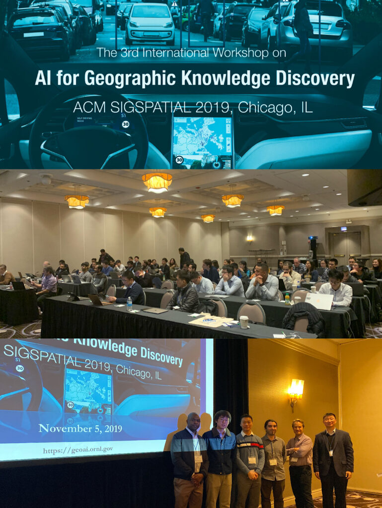
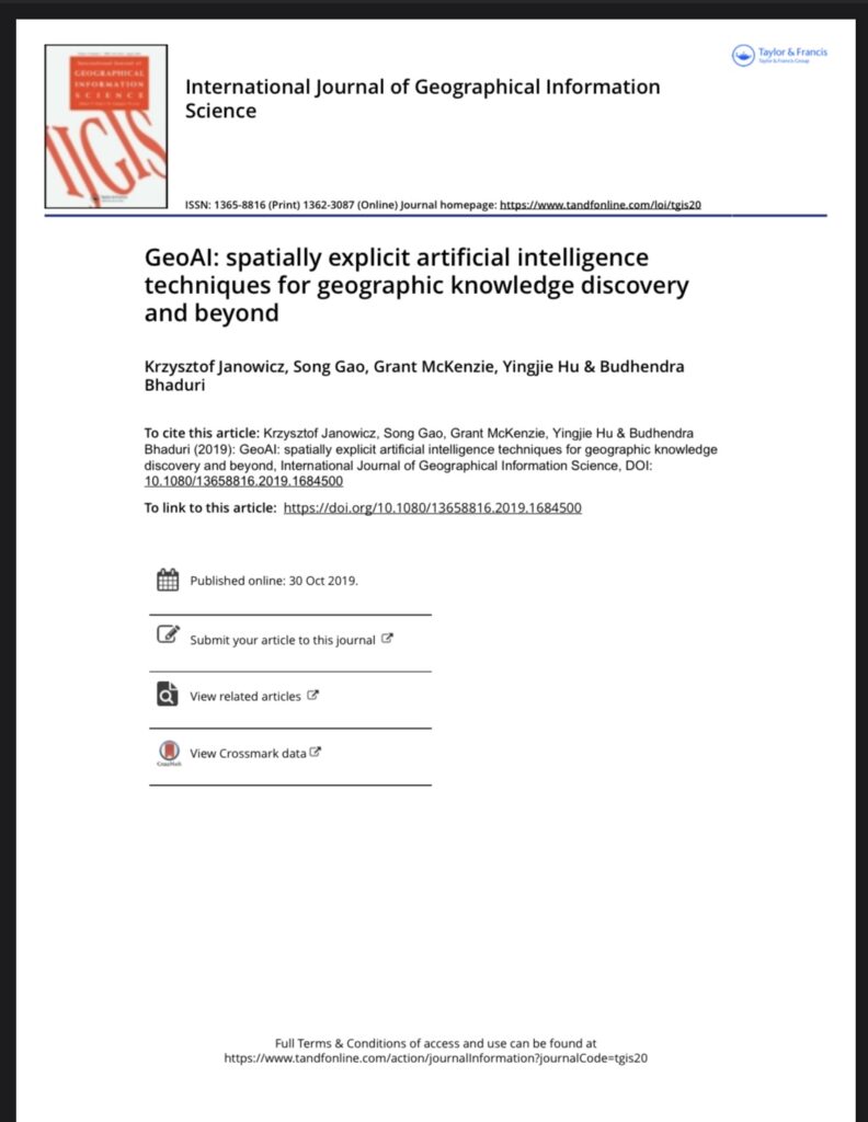
  • GeoAI
  • Geo-APIs
  • Geo-knowledge graphs
  • Geo-semantics
  • Geographic information observatories
  • Geographic information retrieval
  • Geosimulation and spatio-temporal modelling
  • Geovisualization and visual analytics
  • High-performance computing algorithms for spatial-temporal data
  • Human-Computer Interaction (with mobile devices)
  • Image classification methods
  • Internet of Things
  • Location privacy
  • Location-Based Services
  • Navigation
  • Replicability and reproducibility in GIScience
  • Scene recognition
  • Sensitivity analysis for spatial-temporal models
  • Spatial and spatio-temporal statistics
  • Spatial and temporal language
  • Spatial aspects of social computing
  • Spatial data infrastructures
  • Spatial data structures and algorithms
  • Spatially-explicit decision support
  • Spatially-explicit machine learning
  • Standardization and interoperability
  • Time series analysis
  • Trajectory and movement analysis
  • Uncertainty quantification and error propagation
  • Virtual reality


INFORMATION FOR AUTHORS

Full Paper Track

Full research papers will be thoroughly reviewed by at least three members of the international program committee. For this edition of the GIScience series, we will include an optional rebuttal phase during which authors can respond to the (initial) reviews. The rebuttal phase provides an opportunity to address misunderstandings, answer questions, or provide further details on issues that remained unclear to the reviewers. The reviewers will be able to react to these rebuttals by adjusting their review scores, if appropriate. Review criteria include novelty, significance of results as compared to previous work, the quality of the presented evaluations (if applicable), the clarity of the research statement, as well as the quality of writing and supporting illustrations. High-quality submissions will be accepted for presentation at the conference and published in LIPIcs, the Leibniz International Proceedings in Informatics series. Manuscripts must describe original work that has neither been published before, nor is currently under review elsewhere. Papers must be written in English and should not exceed fifteen pages (including title, figures, and references) in the required layout (see below). 

Short Paper Track

Short papers can report on the latest breaking results, present visions for the future of the field, or describe early work and experiments, as well as novel application areas. Short papers will also be reviewed by at least three reviewers. Review criteria include novelty, expected impact of early results, evaluation or evaluation plans for the future, plausibility of presented visions, as well as the quality of writing and supporting illustrations. Accepted papers in this track will be selected for either oral or poster presentations. Short papers must be written in English and should not exceed six pages (including title, figures, and references) in the requested LIPIcs layout. In addition, each submission must include Short Paper as a subtitle. 

The submission Web page for both tracks of GIScience 2020 is: https://easychair.org/conferences/?conf=giscience2020.


IMPORTANT DATES 

  • FULL PAPER TRACK
    • Full paper submissions: March 16, 2020
    • Full paper rebuttal phase: April 24-30, 2020
    • Full paper notification: May 15, 2020
    • Camera-ready papers: June 1, 2020
    • Full paper author registration deadline: June 1, 2020
       
  • SHORT PAPER TRACK
    • Short paper submission: May 25, 2020
    • Short paper notification: July 3, 2020
    • Camera-ready papers: July 15, 2020
    • Short paper author registration deadline: July 15, 2020
FORMATTING INSTRUCTIONS (all tracks)

The layout of any PDF submission to GIScience, whether full paper or short paper, should follow the 2019 template provided by LIPIcs (http://drops.dagstuhl.de/styles/lipics-v2019/lipics-v2019-authors.tgz). LIPIcs also provides a LaTeX class and template for papers. Authors unfamiliar with LaTeX, but keen to try, are highly encouraged to use Overleaf (http://www.overleaf.com), an online LaTeX editor that is easy to use and does not require any local installation. Overleaf comes with the LIPIcs class and template pre-loaded. Authors who want to use other word processors or text editors should stay close to the sample article’s layout for their paper submitted for review. Should their papers be accepted for publication, they will have to be converted to LaTeX using the LIPIcs LaTeX class and template. Authors are responsible for the conversion of their papers to LaTeX. There are also commercial conversion services such as http://wordtolatex.com/upload providing a one-step solution in case you do not want to do the conversion yourself. 

Dynamic Estimation of Individual Exposure Levels to Air Pollution Using Mobile Phone Data

Mingxiao Li, Song Gao, Feng Lu, Huang Tong, Hengcai Zhang. (2019) Dynamic Estimation of Individual Exposure Levels to Air Pollution Using Trajectories Reconstructed from Mobile Phone Data. International Journal of Environmental Research and Public Health. 16(22), 4522. DOI: 10.3390/ijerph16224522

Abstract: The spatiotemporal variability in air pollutant concentrations raises challenges in linking air pollution exposure to individual health outcomes. Thus, understanding the spatiotemporal patterns of human mobility plays an important role in air pollution epidemiology and health studies. With the advantages of massive users, wide spatial coverage and passive acquisition capability, mobile phone data have become an emerging data source for compiling exposure estimates. However, compared with air pollution monitoring data, the temporal granularity of mobile phone data is not high enough, which limits the performance of individual exposure estimation. To mitigate this problem, we present a novel method of estimating dynamic individual air pollution exposure levels using trajectories reconstructed from mobile phone data. Using the city of Shanghai as a case study, we compared three different types of exposure estimates using (1) reconstructed mobile phone trajectories, (2) recorded mobile phone trajectories, and (3) residential locations. The results demonstrate the necessity of trajectory reconstruction in exposure and health risk assessment. Additionally, we measure the potential health effects of air pollution from both individual and geographical perspectives. This helped reveal the temporal variations in individual exposures and the spatial distribution of residential areas with high exposure levels. The proposed method allows us to perform large-area and long-term exposure estimations for a large number of residents at a high spatiotemporal resolution, which helps support policy-driven environmental actions and reduce potential health risks.

GeoDS Lab at the Emerging Technology Leadership Summit 2019

Hyper Innovation is working with the Wisconsin Institutes for Discovery to establish the Emerging Tech Hub@UW-Madison to highlight applications for emerging technologies (e.g., VR/AR), create inspiration for innovation, and provide collaboration opportunities for startups, universities, and corporations.

GeoDS Lab among other campus teams were invited to show the Augmented Reality Beacons demo at the Innovation and Emerging Technology Leadership Summit – November 14, 2019.

VR Playground
AR SandBox

GeoDS Lab at ACM SIGSPATIAL’19

During November 5 – 8, 2019, GeoDS lab members presented at the 27th ACM SIGSPATIAL International Conference on Advances in Geographic Information Systems (ACM SIGSPATIAL 2019) held in Chicago. We had two presentations and got one “Best Poster Award” in the Workshop on Ride-hailing Algorithms, Applications, and Systems (RAAS 2019)

  1. Analyzing the Gap Between Ride-hailing Location and Pick-up Location with Geographical Contexts (Best Poster Award). Yunlei Liang, Song Gao, Mingxiao Li, Yuhao Kang, and Jinmeng Rao (2019). In Proceedings of 1st ACM SIGSPATIAL International Workshop on Ride-hailing Algorithms, Applications, and Systems (RAAS’19) DOI: 10.1145/3357140.3365493 [PDF]
  2. A Data-Driven Approach to Understanding and Predicting the Spatiotemporal Availability of Street Parking (Short Paper). Mingxiao Li, Song Gao, Yunlei Liang, Joseph Marks, Yuhao Kang, and Moyin Li (2019). In Proceedings of 27th ACM SIGSPATIAL International Conference on Advances in Geographic Information Systems(SIGSPATIAL’19) DOI: 10.1145/3347146.3359366 [PDF]

As the General Chairs, Professor Song Gao co-organized the 3rd ACM SIGSPATIAL International Workshop on AI for Geographic Knowledge Discovery (GeoAI 2019). There are two keynotes from both industry and academia and 17 oral presentations in the GeoAI workshop. The proceedings of the GeoAI’19 workshop is available at the ACM Digital Library (Table of Contents): https://dl.acm.org/citation.cfm?id=3356471

GeoAI’19
SIGSPATIAL’19

A roundtable discussion: defining urban data science

Reference: Wei Kang, Taylor Oshan, Levi J Wolf, Geoff Boeing, Vanessa Frias-Martinez, Song Gao, Ate Poorthuis, Wenfei Xu. (2019) A roundtable discussion: defining urban data science. Environment and Planning B: Urban Analytics and City Science. 46(9), 1756-1768.  DOI: 10.1177/2399808319882826 [PDF]

Abstract:

The field of urban analytics and city science has seen significant growth and development in the past 20 years. The rise of data science, both in industry and academia, has put new pressures on urban research, but has also allowed for new analytical possibilities. Because of the rapid growth and change in the field, terminology in urban analytics can be vague and unclear. This paper, an abridged synthesis of a panel discussion among scholars in Urban Data Science held at the 2019 American Association of Geographers Conference in Washington, D.C., outlines one discussion seeking a better sense of the conceptual, terminological, social, and ethical challenges faced by researchers in this emergent field. The panel outlines the difficulties of defining what is or is not urban data science, finding that good urban data science must have an expansive role in a successful discipline of “city science.” It suggests that “data science” has value as a “signaling” term in industrial or popular science applications, but which may not necessarily be well-understood within purely academic circles. The panel also discusses the normative value of doing urban data science, linking successful practice back to urban life. Overall, this panel report contributes to the wider discussion around urban analytics and city science and about the role of data science in this domain.

New IJGIS Editorial on GeoAI

Abstract: What is the current state-of-the-art in integrating results from artificial intelligence research into geographic information science and the earth sciences more broadly? Does GeoAI research contribute to the broader field of AI, or does it merely apply existing results? What are the historical roots of GeoAI? Are there core topics and maybe even moonshots that jointly drive this emerging community forward? In this editorial, we answer these questions by providing an overview of past and present work, explain how a change in data culture is fueling the rapid growth of GeoAI work, and point to future research directions that may serve as common measures of success.

Moonshot (Editorial): Can we develop an artificial GIS analyst that passes a domain-specific Turing Test by 2030?

Keywords: Spatial Data Science, GeoAI, Machine Learning, Knowledge Graphs, Geo-Semantics, Data Infrastructure

Acknowledgement: we sincerely thank all the reviewers who contribute their time to the peer-review process and ensure the quality of the accepted papers.

Special Issue Papers (up to date):

Janowicz, K., Gao, S., McKenzie, G., Hu, Y., and Bhaduri, B. (2020, Editorial). GeoAI: Spatially Explicit Artificial Intelligence Techniques for Geographic Knowledge Discovery and Beyond. International Journal of Geographical Information Science, 34(4), 625-636.

Acheson, E., Volpi, M., & Purves, R. S. (2020). Machine learning for cross-gazetteer matching of natural features. International Journal of Geographical Information Science, 1-27.

Duan, W., Chiang, Y., Leyk, S., Uhl, J. and Knoblock, C. (2020). Automatic alignment of contemporary vector data and georeferenced historical maps using reinforcement learning. International Journal of Geographical Information Science, forthcoming. 1-27; DOI: 10.1080/13658816.2019.1698742.

Guo, Z., & Feng, C. C. (2020). Using multi-scale and hierarchical deep convolutional features for 3D semantic classification of TLS point clouds. International Journal of Geographical Information Science, 1-20.

Law, S., Seresinhe, C. I., Shen, Y., & Gutierrez-Roig, M. (2020). Street-Frontage-Net: urban image classification using deep convolutional neural networks. International Journal of Geographical Information Science, 1-27.

Li, W., & Hsu, C. Y. (2020). Automated terrain feature identification from remote sensing imagery: a deep learning approach. International Journal of Geographical Information Science, 1-24.

Ren, Y., Chen, H., Han, Y., Cheng, T., Zhang, Y., & Chen, G. (2020). A hybrid integrated deep learning model for the prediction of citywide spatio-temporal flow volumes. International Journal of Geographical Information Science, 1-22.

Sparks, K., Thakur, G., Pasarkar, A., & Urban, M. (2020). A global analysis of cities’ geosocial temporal signatures for points of interest hours of operation. International Journal of Geographical Information Science, 1-18.

Xie, Y., Cai, J., Bhojwani, R., Shekhar, S., & Knight, J. (2020). A locally-constrained YOLO framework for detecting small and densely-distributed building footprints. International Journal of Geographical Information Science, 1-25.

Zhu, D., Cheng, X., Zhang, F., Yao, X., Gao, Y., & Liu, Y. (2020). Spatial interpolation using conditional generative adversarial neural networks. International Journal of Geographical Information Science, 1-24.

Dr. Clio Andris Visited UW-Madison Geography

Dr. Clio Andris (Assistant Professor of City & Regional Planning and Interactive Computing) from Georgia Tech was invited to the renowned Yi-Fu Lecture at UW-Madison Geography. Our GeoDS Lab was honored to host Dr. Andris’ visit and had a great conversation on collaborative projects and joint research.

Dr. Andris is giving her talk on spatial social network analysis.
Grads Brown-Bag Talk
UW-Madison’s own made ice cream

Prof. Song Gao received a new NSF Research Grant

Recently, Dr. Song Gao (Co-PI) received a NSF grant together with Dr. Qunying Huang (PI), Dr. Daniel Wright (Co-PI), Dr. Nick Fang (Co-PI), and Dr. Yi Qiang (Co-PI).

Title: A GeoAI Data-Fusion Framework for Real-Time Assessment of Flood Damage and Transportation Resilience by Integrating Complex Sensor Datasets

Abstract: Traditional modeling approaches for flood damage assessment are often labor-intensive and time-consuming due to requirements for domain expertise, training data, and field surveys. Additionally, the lack of data and standard methodologies makes it more challenging to assess transportation network resilience in real-time during flood disasters. To address these challenges, this project aims to integrate novel data streams from both physical sensor networks (e.g., remotely-sensed data using unmanned aerial vehicles [UAVs]), and citizen sensor networks (e.g., crowdsourced traffic data, social media and community responsive teams connected through a developed mobile app). The goal is to develop a framework for real-time assessment of damage and the resilience of urban transportation infrastructures after coastal floods via the state-of-the-art computer vision, deep learning and data fusion technologies. The project will also advance Data Science through multi-disciplinary and multi-institutional collaborations. The project is expected to improve the sustainability, resilience, livability, and general well-being of coastal communities by having a direct impact on the effectiveness, capability, and potential of using both physical and social sensor data. This will in turn enable and transform damage assessments, and identify critical and vulnerable components in transportation networks in a more effective and efficient manner. The interdisciplinary research team, along with students and collaborators from different coastal regions, will facilitate the sharing of knowledge and technologies from different socio-environmental contexts and testing the transferability of the research outcomes.

The project will harmonize physical and citizen sensors within a geospatial artificial intelligence (GeoAI) data-fusion framework with a focus on three research thrusts: (1) unsupervised flood extent detection by integrating UAV images collected throughout this project with existing geospatial data (e.g., road networks and building footprints); (2) flood depth estimation using deep learning and computer vision techniques combined with crowdsourced photos and UAV imagery; and (3) assessment of the impact on and resilience of transportation networks based on near real-time flood and damage information. The innovative methodology will be demonstrated and deployed through collaborative efforts in response to future flood events as well as several historical storms. The project will produce open-source algorithms for future educational use, raw and processed datasets and associated processing software, a mobile app to engage community responsive science teams, and three research publications.

Source: https://www.nsf.gov/awardsearch/showAward?AWD_ID=1940091

The fusion of knowledge-driven and data-driven approaches to discovering urban functional regions

Papadakis, E., Gao, S., & Baryannis, G. (2019). Combining Design Patterns and Topic Modeling to Discover Regions Supporting Particular Functionality. ISPRS International Journal of Geo-Information. 8(9), 385; https://doi.org/10.3390/ijgi8090385.

Abstract

The problem of discovering regions that support particular functionalities in an urban setting has been approached in literature using two general methodologies: top-down, encoding expert knowledge on urban planning and design and discovering regions that conform to that knowledge; and bottom-up, using data to train machine learning models, which can discover similar regions. Both methodologies face limitations, with knowledge-based approaches being criticized for scalability and transferability issues and data-driven approaches for lacking interpretability and depending heavily on data quality.

To mitigate these disadvantages, we propose a novel framework that fuses a knowledge-based approach using design patterns and a data-driven approach using latent Dirichlet allocation (LDA) topic modeling in three different ways: Functional regions discovered using either approach are evaluated against each other to identify cases of significant agreement or disagreement; knowledge from patterns is used to adjust topic probabilities in the learning model; and topic probabilities are used to adjust pattern-based results. The proposed methodologies are demonstrated through the use case of identifying shopping-related regions in the Los Angeles metropolitan area. Results show that the combination of pattern-based discovery and topic modeling extraction helps uncover discrepancies between the two approaches and smooth inaccuracies caused by the limitations of each approach.

Figure. The proposed framework of fusing knowledge-based and data-driven approaches
Figure. Extracted shopping regions by combining data-to-knowledge and knowledge-to-data approaches.

Prof. Song Gao received an AI for Earth Grant from Microsoft

[Madison, WI/USA] – [August 8, 2019] – Professor Song Gao as the Principal Investigator (PI) has been awarded an AI for Earth research grant from Microsoft to help further the efforts in the area of Geospatial Artificial Intelligence (GeoAI).

This new grant will provide Dr. Song Gao and his research assistants Yuhao Kang and Jake Kruse at the GeoDS@UW-Madison lab, and Dr. Fan Zhang (Postdoc Researcher at the MIT Senseable city Lab and Peking University) with the Azure cloud computing resources and AI data labelling services to accelerate their work on understanding the playability of cities and metropolitan areas from the human-environment interaction perspective using multi-source geospatial big data (e.g., images, texts, and videos).

The Microsoft AI for Earth is a $50 million, 5-year program that brings the full advantage of Microsoft technology to those working to solve global environmental challenges in the key focus areas of climate, agriculture, water and biodiversity. Through grants that provide access to cloud and AI tools, opportunities for education and training on AI, and investments in innovative, scalable solutions, AI for Earth works to advance sustainability across the globe. 

Learn more about the Microsoft AI for Earth program: https://www.microsoft.com/en-us/aiforearth 

A theoretical framework of modeling vague areal objects in GIScience

Liu, Y., Yuan, Y., & Gao, S. (2019). Modeling the Vagueness of Areal Geographic Objects: A Categorization SystemISPRS International Journal of Geo-Information8(7), 306. DOI: https://doi.org/10.3390/ijgi8070306

Abstract: Modeling vague objects with indeterminate boundaries has drawn much attention in geographic information science (GIScience). Because fields and objects are two perspectives in modeling geographic phenomena, this paper investigates the characteristics of vague regions from the perspective of the field/object dichotomy. Based on the assumption that a vague object can be viewed as the conceptualization of a field, we defined five categories of vague objects: (1) direct field-cutting objects, (2) focal operation-based field-cutting objects, (3) element-clustering objects, (4) object-referenced objects, and (5) dynamic boundary objects. We then established a categorization system to formalize the semantic differences between vague objects using the fuzzy set theory. The proposed framework provides valuable input for the conceptualization, interpretation, and modeling of vague geographical objects.

Figure. The categorization system of the five categories of fuzzy regions and their relations.

Full Paper about “Trajectory Reconstruction” accepted at Computers, Environment and Urban Systems

Citation info: Mingxiao Li, Song Gao, Feng Lu, Hengcai Zhang. (2019) Reconstruction of human movement trajectories from large-scale low-frequency mobile phone data. Computers, Environment and Urban Systems, Volume 77, September 2019, 101346. DOI: 
10.1016/j.compenvurbsys.2019.101346

Abstract

Understanding human mobility is important in many fields, such as geography, urban planning, transportation, and sociology. Due to the wide spatiotemporal coverage and low operational cost, mobile phone data have been recognized as a major resource for human mobility research. However, due to conflicts between the data sparsity problem of mobile phone data and the requirement of fine-scale solutions, trajectory reconstruction is of considerable importance. Although there have been initial studies on this problem, existing methods rarely consider the effect of similarities among individuals and the spatiotemporal patterns of missing data. To address this issue, we propose a multi-criteria data partitioning trajectory reconstruction (MDP-TR) method for large-scale mobile phone data. In the proposed method, a multi-criteria data partitioning (MDP) technique is used to measure the similarity among individuals in near real-time and investigate the spatiotemporal patterns of missing data. With this technique, the trajectory reconstruction from mobile phone data is then conducted using classic machine learning models. We verified the method using a real mobile phone dataset including 1 million individuals with over 15 million trajectories in a large city. Results indicate that the MDP-TR method outperforms competing methods in both accuracy and robustness. We argue that the MDP-TR method can be effectively utilized for grasping highly dynamic human movement status and improving the spatiotemporal resolution of human mobility research.